

Roof & Building Envelope Inspection
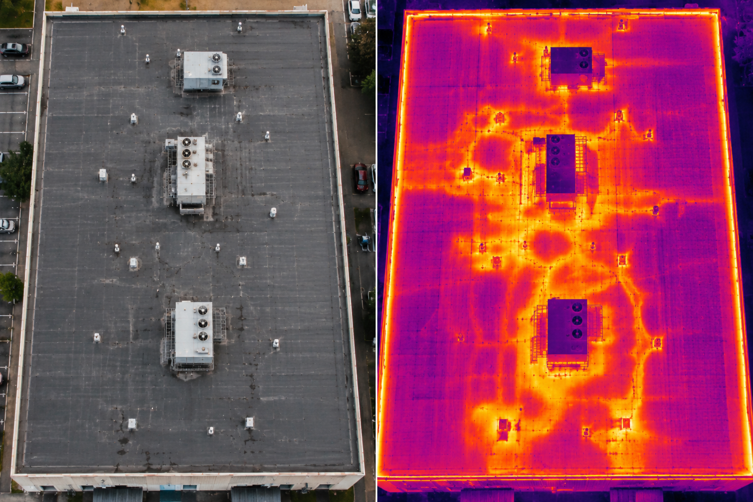
Catch roof problems while they’re still cheap to fix. Combined visual and thermal aerial scans reveal moisture intrusion, membrane damage, and insulation loss, no one has to step foot on the roof.
- Visual and thermal aerial roof scans
- Photo documentation for insurance and warranty claims
- Moisture detection before it becomes a distructive leak
- Safer and faster than a manual roof walk
Facade & Vertical Envelope Inspection
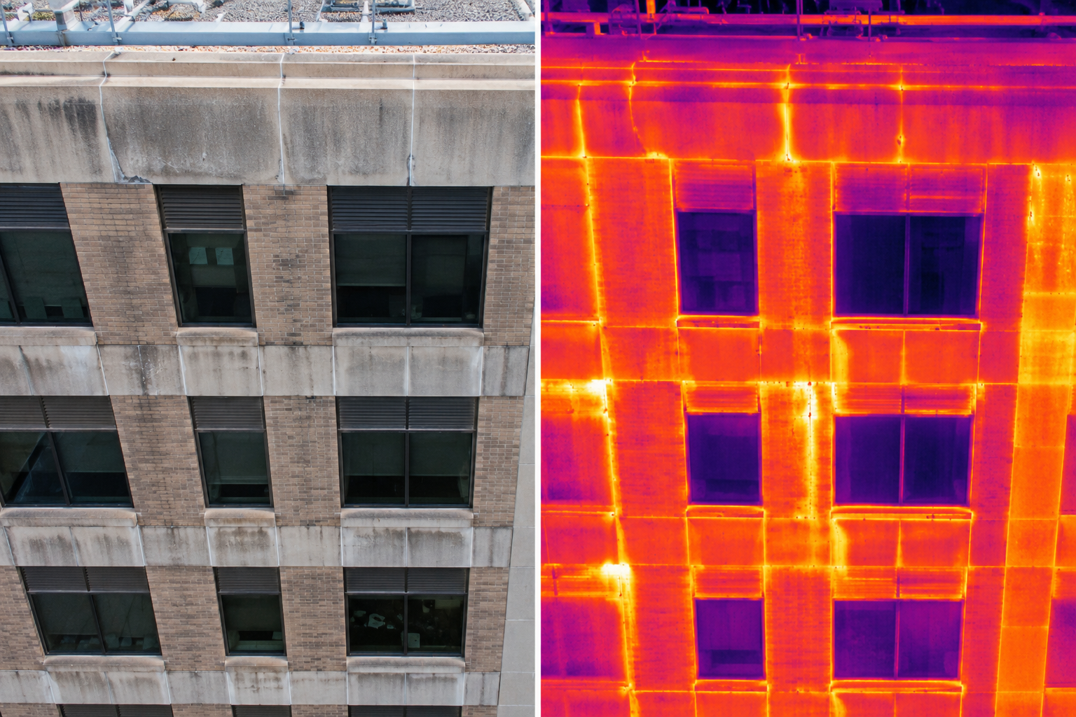
A close, high-resolution look at your building’s exterior skin, without the cost, scheduling, or safety risk of a swing stage or lift. Great for catching cracked masonry, failing sealant joints, and cladding issues early.
- High-resolution exterior facade imaging
- No lift, scaffold, or swing-stage required
- Spots sealant, masonry, and cladding issues early
- Optional thermal pass for insulation and moisture behind the wall
Construction & Site Mapping
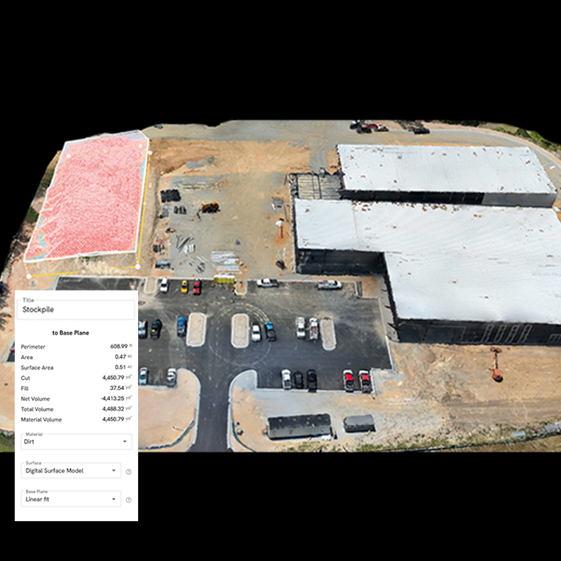
Turn a job site into usable data. Aerial mapping produces accurate, geo-referenced site imagery and 3D data that plug directly into the engineering and design tools your team already uses.
- Geo-referenced 2D site maps
- 3D point clouds and mesh models for engineering software
- Topographic and volumetric cut/fill data
- Compatible with AutoCAD, Civil 3D, and GIS platforms
Construction Progress Monitoring
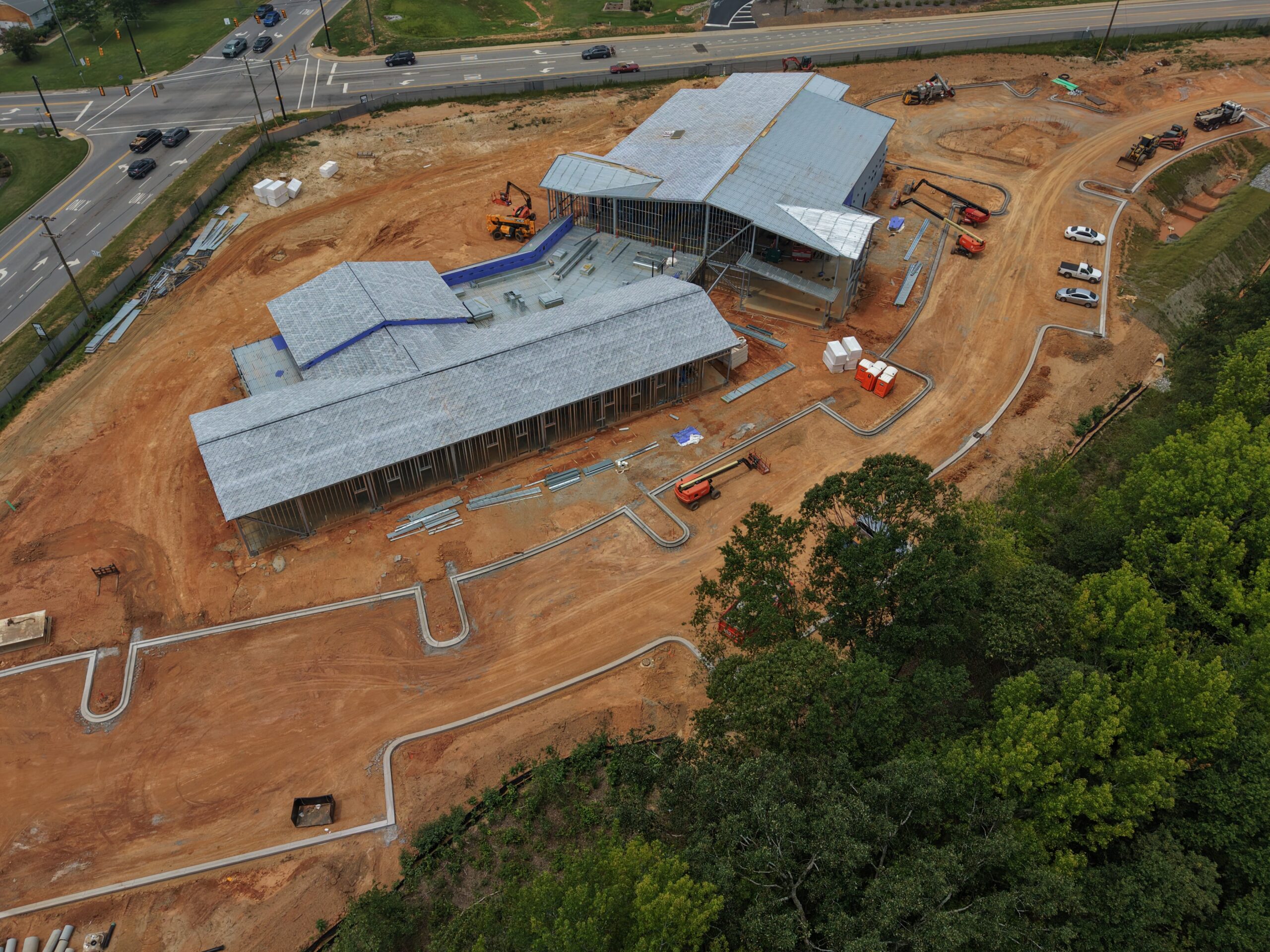
Keep every stakeholder on the same page, literally. Recurring aerial capture gives lenders, owners, and project teams an objective visual record of progress, no site visit required.
- Scheduled recurring site capture, weekly, bi-weekly, or monthly
- An objective visual progress record for lenders and owners
- Easy to share across every project stakeholder
- Builds a running visual history of the build
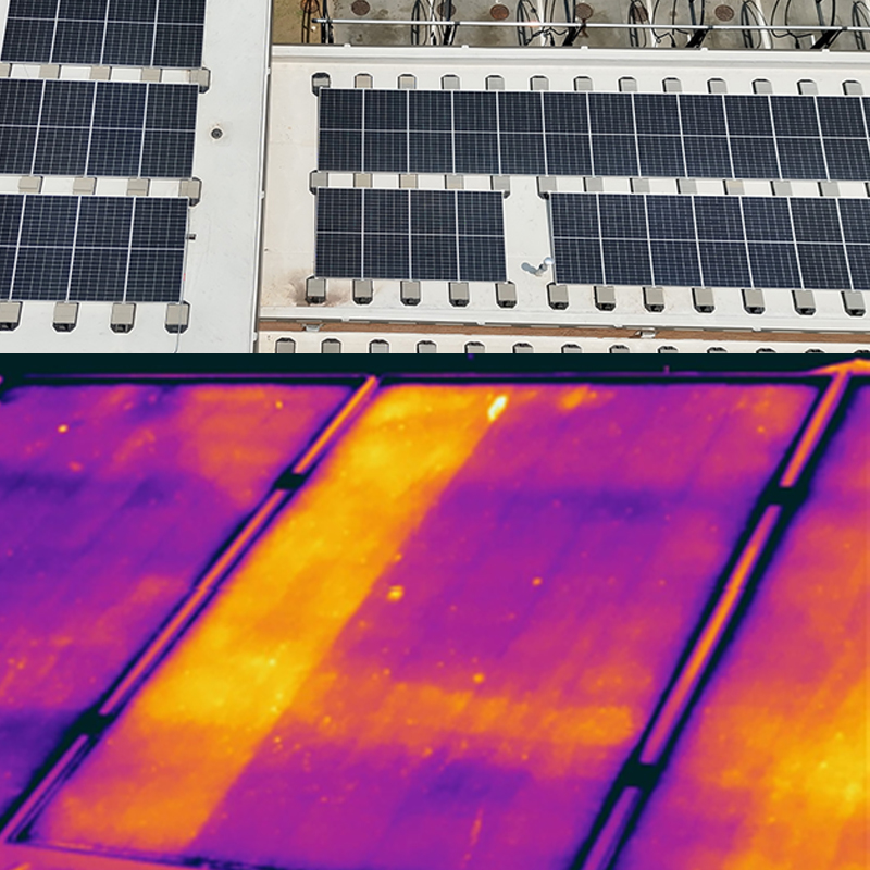
Solar Panel Inspection
Spot underperforming panels before they cost you a season of production. A single thermal flight identifies failed cells, damaged strings, and connection issues across the entire array.
- Full-array thermal scan in a single flight
- Identifies failed or underperforming panels and strings
- Annotated report to prioritize maintenance
- Minimal disruption to facility operations
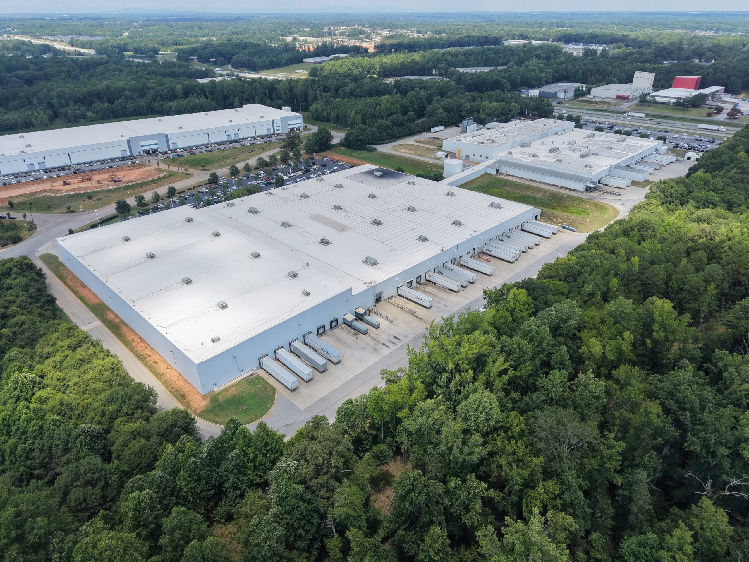
Real Estate & Asset Marketing Media
Give a listing the vantage point it deserves. Aerial photo and video help a property stand out in a crowded market, from marketing flyers to due-diligence packets.
- Professional aerial photo and video packages
- Site context ground-level photography can’t capture
- Optional 3D property models for standout listings
- Fast turnaround for time-sensitive listings
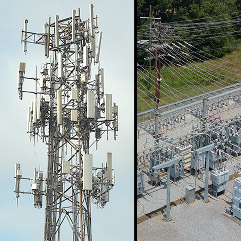
Cell Tower & Electrical Infrastructure Documentation
A safer, faster way to get eyes on hard-to-reach infrastructure. Visual and thermal aerial documentation gives your team a clear record to review, without the cost or risk of a physical climb.
- Visual and thermal documentation of towers and electrical structures
- Captured in a single daytime flight
- Safer and faster than a manual climb inspection
- Findings delivered for your team’s or engineer’s review
This is a documentation service for your team’s review, not a certified electrical, structural, or NDT inspection.
Discuss a Project